GIS Training

The diverse GIS skills and experience levels of the employees of GeoAfrika Technologies enables the provision of GIS training services for all skill levels. Our training services typically complement full time, formal GIS courses with one-on-one, hands-on training. This level of practical on-site training empowers our clients to both fully utilise and gain full value from their technology investments. GIS training activities have included supporting our clients to attain the required depth of GIS and spatial knowledge and experience as required for registration under the South African Geomatics Council (SAGC). This service is an integral part of empowering our clients through knowledge and skills transfer on every project undertaken.

Projects

Implementation of the spatial integration framework and the revision of the current GIS based spatial equity tool

Implementing spatial integration framework and revising GIS-based spatial equity tool

Focus Project Management, together with GeoAfrika Technologies have been appointed to support KZN CoGTA with the implementation of the Spatial Integration Framework (SIF) and the revision of the current GIS based Spatial Equity Tool (SEPT). This includes the analysis, testing and the updating of the existing tool to align with
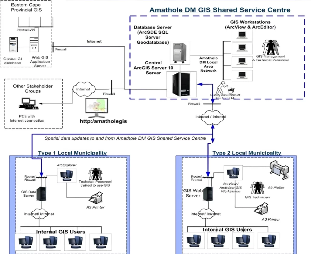
GeoAfrika developed a custom GIS web portal for Amathole District Municipality, providing secure access to integrated spatial and non-spatial datasets that support property management, planning, and informed municipal decision-making.

Amathole District Municipality GIS Web Portal

The Amathole District Municipality GIS web portal consists of a traditional information portal and a number of customised GIS-based views. The views include an Integrated Municipal Property Information System that allows users to view and query detailed municipal property information in association with a number of GIS datasets that have
GeoAfrika developed a custom GIS web portal for Amathole District Municipality, providing secure access to integrated spatial and non-spatial datasets that support property management, planning, and informed municipal decision-making.

Municipal Environmental Profiles For 44 District Municipalities

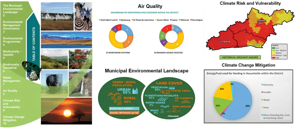
The National Department of Environmental Affairs (DEA) appointed GeoAfrika Technologies, in associated with WSP Environmental, to undertake the compilation of municipal environmental profiles for all 44 District Municipalities in South Africa. The aim of this was to provide a better context of the municipal environment and to provide them with

Verification of Existing Lawful Water Use Within the Inkomati WMA

The verification of existing lawful water use is a requirement of the National Water Act, Act 36 of 1998. It enables the transition of water use entitlements from the previous Water Act of 1956. The process also quantifies the extent of current water use for catchment management purposes and to
Usuthu Catchment - Validation and Verification of Existing Lawful Water Use

Usuthu Catchment: Validation and Verification of Existing Lawful Water Use

The Inkomati-Usuthu Catchment Management Agency appointed GeoAfrika Technologies to manage and carry out the Validation and Verification of Existing Lawful Water Use, in terms of Section 35 of the National Water Act, in the Usuthu Catchment area. This project involved the generation and manipulation of various spatial and non-spatial datasets
KZN Department of Transport - GIS Maintenance and Support

KZN Department of Transport – GIS Maintenance and Support

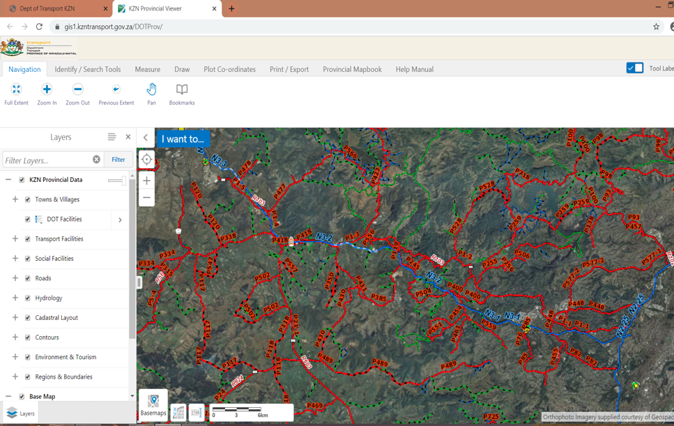
This project is a continuation of a long term association with the KZN DOT, where GeoAfrika Technologies has provided specialist support and GIS software and maintenance services. This project included ongoing maintenance of the KZN DOT Road Network (215 000 km), support to the GIS software environment, re-develop the KZN