Project and Programme Management

The provision of project and programme management services is frequently a requirement in longer term projects. GeoAfrika Technologies has demonstrated the ability to develop a comprehensive understanding of each client’s business and project requirements in order to correctly direct and manage the project components and resources. Projects typically require the development of process workflows to systemise a client’s operations to ensure alignment with technical, legal, administrative and business requirements. Such workflows create consistency and efficiency within a business process with the added advantage of real time reporting on progress and task completion. This management service also extends to larger projects where management of diverse inputs and deliverables from different companies and stakeholders is a requirement.

Projects

Tongaat Hulett Property GIS Support Service

Tongaat Hulett Property GIS Support Service

GeoAfrika Technologies has provided Tongaat Hulett Developments with continuous service since 2002. This support includes; provision of a full-time onsite GIS Technician, the provision of GIS resources as back-up to the onsite Technician and for supplementary work, the provision of a GIS Specialist to oversee the technical aspects of the
United Nations Population Fund - Adolescent and Health Service Mapping

United Nations Population Fund – Adolescent and Health Service Mapping

The UNFPA appointed GeoAfrika Technologies to map adolescent sexual and reproductive health, and HIV service delivery points and providers, and to provide a user-friendly GIS database and viewer that can be used to interrogate this data. The points were mapped in the 8 UNFPA supported priority district municipalities in the
Integrated Municipal Property Information Management System

Integrated Municipal Property Information Management System

The Integrated Municipal Property Information System is a Geographical Information Systems (GIS) web-based system that enables users to view and query municipal property-related information from multiple departments within a municipality from a single web portal. This system has been implemented at Ingwe and Kokstad Local Municipalities and all seven of
GeoAfrika developed a custom GIS web portal for Amathole District Municipality, providing secure access to integrated spatial and non-spatial datasets that support property management, planning, and informed municipal decision-making.

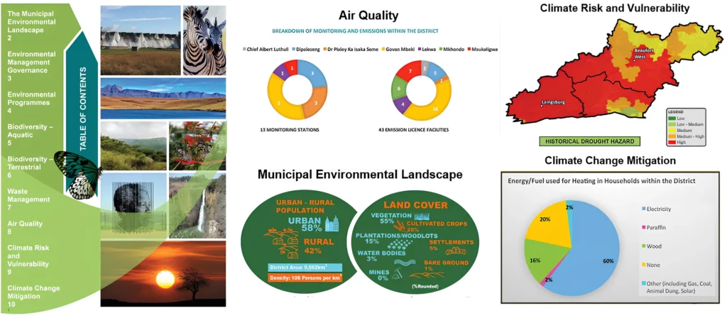
Municipal Environmental Profiles For 44 District Municipalities

The National Department of Environmental Affairs (DEA) appointed GeoAfrika Technologies, in associated with WSP Environmental, to undertake the compilation of municipal environmental profiles for all 44 District Municipalities in South Africa. The aim of this was to provide a better context of the municipal environment and to provide them with

Verification of Existing Lawful Water Use Within the Inkomati WMA

The verification of existing lawful water use is a requirement of the National Water Act, Act 36 of 1998. It enables the transition of water use entitlements from the previous Water Act of 1956. The process also quantifies the extent of current water use for catchment management purposes and to
Usuthu Catchment - Validation and Verification of Existing Lawful Water Use

Usuthu Catchment: Validation and Verification of Existing Lawful Water Use

The Inkomati-Usuthu Catchment Management Agency appointed GeoAfrika Technologies to manage and carry out the Validation and Verification of Existing Lawful Water Use, in terms of Section 35 of the National Water Act, in the Usuthu Catchment area. This project involved the generation and manipulation of various spatial and non-spatial datasets