GIS Web Development and System Hosting

GeoAfrika Technologies provides a comprehensive GIS web development and system hosting service that has been built up through strong client demand. The development of GIS websites are frequently included in GIS projects as an important deliverable to enable view, query and analysis of project data and information. With the proliferation of mobile technology there is a need that development in this area produces products that are compatible on all platforms and devices. GeoAfrika Technologies is able to provide a reliable and secure hosting environment from our server infrastructure in Durban that is secured by full UPS and power generator backup. High speed internet lines and redundant failover servers ensure the delivery of premium hosting services with close to 100% uptime.

Projects

Implementation of the spatial integration framework and the revision of the current GIS based spatial equity tool

Implementing spatial integration framework and revising GIS-based spatial equity tool

Focus Project Management, together with GeoAfrika Technologies have been appointed to support KZN CoGTA with the implementation of the Spatial Integration Framework (SIF) and the revision of the current GIS based Spatial Equity Tool (SEPT). This includes the analysis, testing and the updating of the existing tool to align with
Integrated Municipal Property Information Management System

Integrated Municipal Property Information Management System

The Integrated Municipal Property Information System is a Geographical Information Systems (GIS) web-based system that enables users to view and query municipal property-related information from multiple departments within a municipality from a single web portal. This system has been implemented at Ingwe and Kokstad Local Municipalities and all seven of
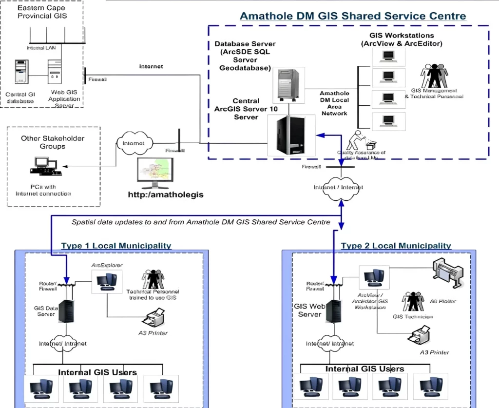
GeoAfrika developed a custom GIS web portal for Amathole District Municipality, providing secure access to integrated spatial and non-spatial datasets that support property management, planning, and informed municipal decision-making.

Amathole District Municipality GIS Web Portal

The Amathole District Municipality GIS web portal consists of a traditional information portal and a number of customised GIS-based views. The views include an Integrated Municipal Property Information System that allows users to view and query detailed municipal property information in association with a number of GIS datasets that have
GeoAfrika developed a custom GIS web portal for Amathole District Municipality, providing secure access to integrated spatial and non-spatial datasets that support property management, planning, and informed municipal decision-making.

Municipal Environmental Profiles For 44 District Municipalities

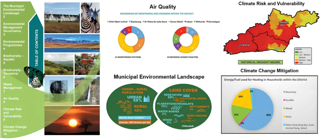
The National Department of Environmental Affairs (DEA) appointed GeoAfrika Technologies, in associated with WSP Environmental, to undertake the compilation of municipal environmental profiles for all 44 District Municipalities in South Africa. The aim of this was to provide a better context of the municipal environment and to provide them with
Usuthu Catchment - Validation and Verification of Existing Lawful Water Use

Usuthu Catchment: Validation and Verification of Existing Lawful Water Use

The Inkomati-Usuthu Catchment Management Agency appointed GeoAfrika Technologies to manage and carry out the Validation and Verification of Existing Lawful Water Use, in terms of Section 35 of the National Water Act, in the Usuthu Catchment area. This project involved the generation and manipulation of various spatial and non-spatial datasets
KZN Department of Transport - GIS Maintenance and Support

KZN Department of Transport – GIS Maintenance and Support

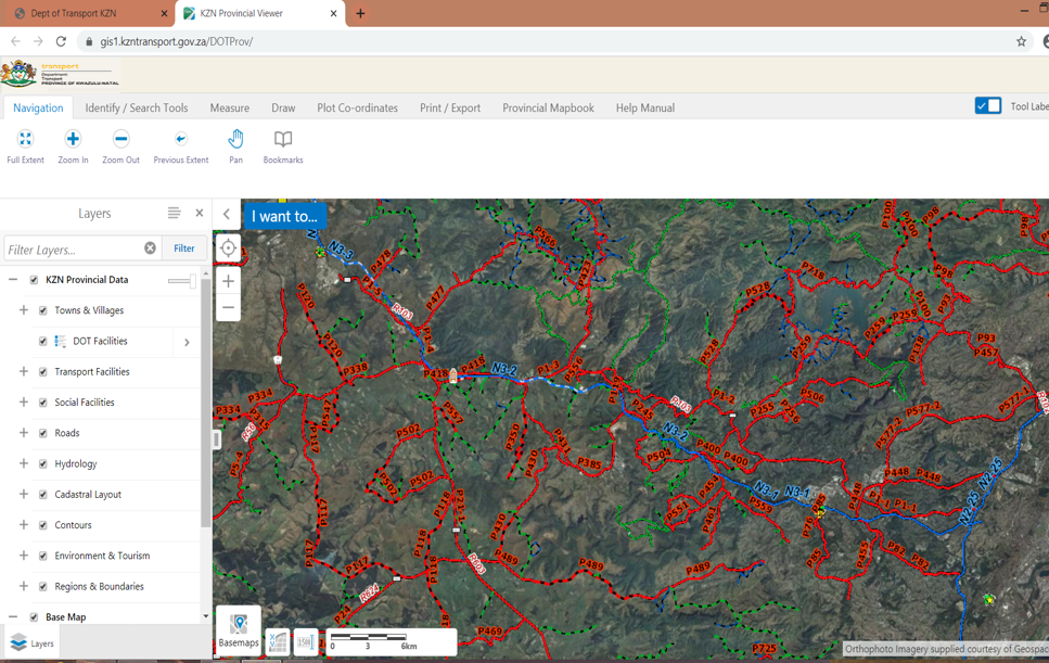
This project is a continuation of a long term association with the KZN DOT, where GeoAfrika Technologies has provided specialist support and GIS software and maintenance services. This project included ongoing maintenance of the KZN DOT Road Network (215 000 km), support to the GIS software environment, re-develop the KZN