Software and system development

A significant number of projects undertaken by GeoAfrika Technologies have a system development component. These developments are typically bespoke systems designed to meet the specific needs of a client, be they a project in themselves or a means to add value to information generated through a project. GeoAfrika Technologies is able to develop on a variety of platforms with considerable experience in design and implementation. Database design is an integral part of the system development projects and use is made of both Microsoft SQL Server and Oracle database software. In keeping with the company’s origins, systems developed frequently include a spatial component.

Projects

United Nations Population Fund - Adolescent and Health Service Mapping

United Nations Population Fund – Adolescent and Health Service Mapping

The UNFPA appointed GeoAfrika Technologies to map adolescent sexual and reproductive health, and HIV service delivery points and providers, and to provide a user-friendly GIS database and viewer that can be used to interrogate this data. The points were mapped in the 8 UNFPA supported priority district municipalities in the
Integrated Municipal Property Information Management System

Integrated Municipal Property Information Management System

The Integrated Municipal Property Information System is a Geographical Information Systems (GIS) web-based system that enables users to view and query municipal property-related information from multiple departments within a municipality from a single web portal. This system has been implemented at Ingwe and Kokstad Local Municipalities and all seven of
District Health Information System

District Health Information System

The District Health Information System provides an efficient and user friendly platform to support the monthly and quarterly reporting requirements of the KwaZulu-Natal Department of Health. Officials at hospitals, clinics and district and regional offices are able to set monthly and quarterly performance targets and to capture actual performance against
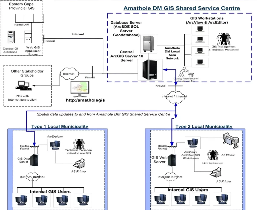
GeoAfrika developed a custom GIS web portal for Amathole District Municipality, providing secure access to integrated spatial and non-spatial datasets that support property management, planning, and informed municipal decision-making.

Amathole District Municipality GIS Web Portal

The Amathole District Municipality GIS web portal consists of a traditional information portal and a number of customised GIS-based views. The views include an Integrated Municipal Property Information System that allows users to view and query detailed municipal property information in association with a number of GIS datasets that have
GeoAfrika developed a custom GIS web portal for Amathole District Municipality, providing secure access to integrated spatial and non-spatial datasets that support property management, planning, and informed municipal decision-making.

Municipal Environmental Profiles For 44 District Municipalities

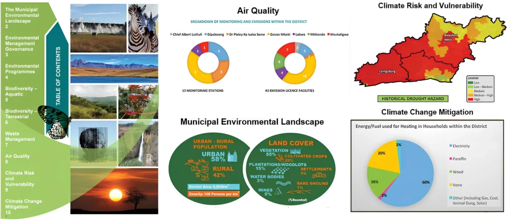
The National Department of Environmental Affairs (DEA) appointed GeoAfrika Technologies, in associated with WSP Environmental, to undertake the compilation of municipal environmental profiles for all 44 District Municipalities in South Africa. The aim of this was to provide a better context of the municipal environment and to provide them with

National Skills Fund Information Management System

The National Skills Fund (NSF) portal is a web-based learner information management system. The system is made up of a number of modules that support the business processes of the NSF, as administered by Bigen Africa Services. The system tracks the progress of more than 400 registered learners. Each learner